Saturday, November 7, 2009

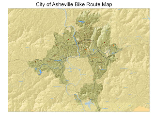
Bike Map


Just saw the email that we're supposed to post our maps. Here's mine so far. I still need to annotate and edit labels, but I think the colors and scale are pretty much done. I've been working on this at home alot and find a few differences between the 9.2 I have on my lap top and 9.3 at school. Wish I had more time to use the lab during the day--I'm up really early for work and my brain doesn't work so well at night. When I work on projects at home, I'm about 100 times more productive than I am at 9:00 at night in lab. For some reason, I can't seem to pull it together and since I'm tired, I just get angry and frustrated. Anyway, here it is--still a work in progress. One question I'd like some input from class: what size font should we use with such a large format map? I haven't done a test print yet, but would like to get the fonts down before I do it. Any suggestions?

Tuesday, September 15, 2009

Annotations! Show Excitement! Or Emotion!


Here's my regional annotation project map. I could agonize over the size, placement, color, font of every letter of every label and the symbol style, size, color, placement, too. But I'm not. I'm done. Well, I'm not done, but I'm stopping. I feel pretty good about this one--better than the last one. Probably because this map was a familiar type of map and I could use maps I've seen as models for this one.

Now I'm going home to study for the test next week.

Good Luck everybody.

Tuesday, September 1, 2009

Browse your fonts

Tonight Pete told us to browse our fonts. He said "font" enough times in a row during lecture that it started sounding funny--like a dirty word!

I'm really enjoying this class soooo much more than the database class. Only thing missing is Edward.

Tonight I learned to store relative paths to eliminate data source problems. When I save maps to 9.2 version for working on at home, the source settings don't transfer and I get annoying red exclamation marks on my layer titles.

We're also starting to do annotation, which is the best way to label features--but I have to remember it's a DATA FRAME feature--NOT a layer property.

More soon, I'm sure.

Landslide Map


Here's my landslide map.
Wish we'd learned about labels before making this one.
Curious how it'll look printed.

Tuesday, August 25, 2009

One More Time

I'm BAaaaaaack. Again
I'm back in the saddle, and feeling better about my productivity level this time around. Some of the things I learned two years ago are coming back. I had to drop the course when I fell and fractured a vertebrae. Having taken 215 in between certainly helped.

I selected by attribute, location, I buffered and clipped. I navigated downloads and zip files, and I added attribute fields and used a field calculator, all in the first lab! Whew! My homework will be to create a report with the ESRI report tool, which is new territory for me.

Now I need to remember how to save my file created in 9.3 so I can work on it in my 9.2 version. May need Pete's help with that.

More soon, I'm sure.

Thursday, October 18, 2007

Sayonara

Well fellas.

I have to say so long. I hate it, but it's true. Took a tumble that put me down for a good while. I hope to be back next time around, but it depends on progress in physical therapy. I had lots of fun while it lasted--the dream class for sure. Just the right amount of not too much snarkiness, and plenty of levity. Good luck with the program, and keep in touch. I sure can use the distraction about now. I'll check in now and again to witness the awesome cartography you're sure to crank out.

Later, taters.

Wednesday, October 3, 2007

Oct. 3, 2007


Started a big map project of western NC, starting with Lidor raster data of elevation and hillshades, and adding cities, waterbodies, and points of interest, etc. I'm still having trouble with file management, and wondering if I'll ever understand computers well enough to be good at this. Anyway, I'm waiting for files to download, so I thought I'd get started on tonights blog. I took the exam before class (makeup) and feel I did pretty well. Now if I could only be so confident about my data management! And Pete just told me how to export map data and I completely spaced out on how to do it. But it's 9:30 and I'm tired of this mess, so I'm just going to upload my map, if possible, and be done with it. I say if possible, because the last time I tried to upload a raster-based image, it didn't work. But that was in Arcview. All the little dots are a city file that I haven't clipped to my region. But clips can't be performed on raster data, so I have to merge my county boundaries to create a layer file that I can perform edits on and clip layers to. That's where the whole export map data info Pete just gave me would come in handy. There's some way I can select attributes I want to keep (cities in my region) and export only those cities and automatically exclude the others. There's always next week, but I'm feeling discouraged, and wonder if it's all worth the effort. And work takes alot more out of me than I thought it would. I LIKE the work, but it certainly makes coming to class more difficult. I just wish I weren't such a computer dunce.